Projects
Community Project
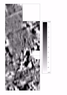
A community project just outside Newark revield some intresting enclosures and a possible Roman iron smelting furnace. Due to the results from the geophysics, we decided to dig a test pit over the location of the possible iron smelting furnace. Within the test a single feature was seen, which probably formed the edge of a pit. Three peices of Roman pottery was recorded from its fill, which indectes the there is definatly Roman activity whith the area.
As well as the Roman pottery the the test pit contained two pieces of slag and some charcoal, suggesting there could be a Iron Smelting furnace with the area.
A community project just outside Sleaford:
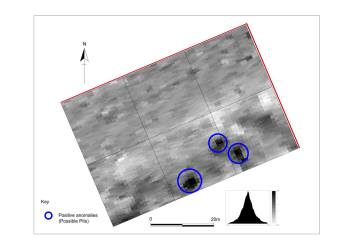
Two lighter patches of soil visable as small mounds within the field were investigated for and with the help of a local archaeology group.
The results show three possible pits (circled in blue) on the southern edge of the lighter patches of soil seen in the aerial photos. It is likely that these areas were used for small scale quarrying, with the lighter patches forming the waste material from the quarry pits.
Howell Community Project
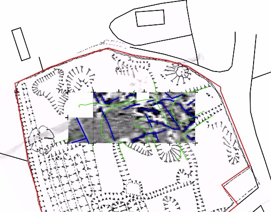
The results from the Howell Community Project. The background map is from an earthwork survey completed in 1979. I have overlaid this map with the geophysics with the green lines showing the earthwork survey results and the blue line representing the positive linear features (ditches) within our survey area. the survey area was 40m by 100m with each gird 20m in size.
The results show a number of linear features on a NE-SW alignment. As this is consistent with the Medieval ridge and furrow to the west, they are likely to date to a similar period. The linear appear to form a grid, suggesting that they may be part of a settlement, forming animal enclosures, and possible house plots. As the site is located just to the south of the Church, the features are likely to from the remains of the medieval settlement connected to the church built in the 13th century.
Due to the small size of the survey area, it is difficult to gain a better understanding of the results. We are hoping to revisit the site with members of Old Sleaford Heritage Group in the coming months to complete a larger area.
Photos from our recent cropmark survey
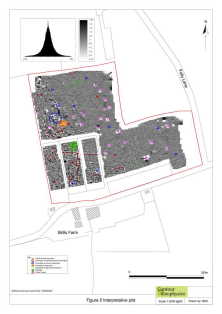
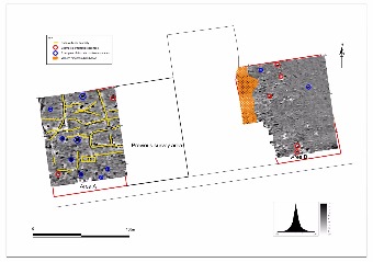
Geophysics Results
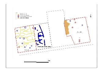
Positive linear anomalies (Yellow Lines)
Twenty-three positive anomalies of a possible archaeological origin have been identified in Area A. These include possible enclosures, trackways and field boundaries. The intensity of activity in this area suggests they may form part of a settlement or farmstead and the shape would suggest they may be Iron Age or Roman in date.
No similar features were found in Area B.
Discrete positive anomalies (Blue Circles)
Examples of discrete positive anomalies are highlighted and possibly represent pit features. These are prevalent in Area A, however, examples located in Area B are somewhat isolated and are difficult to interpret on the basis of form alone.
Iron spikes (discrete bipolar anomalies) (Red Circles)
Iron items within the topsoil give a distinctive localised bipolar (strong positive with associated strong negative) response. Such items usually derive from relatively recent management or use of the land.
Magnetic disturbance (Orange Hatching)
Strong bipolar responses represent a scatter of ferrous material, possibly forming building debris, metal fencing, pathway and general debris.
DISCUSSION
Area A contains 23 linear features forming possible enclosures, trackways and field boundaries possibly dating to the Iron Age/Roman Period. The features found in Area A possibly form part of a farmstead or the edge of a larger settlement to the west of the site. With the lack of features located in the eastern area (Area B) it is possible that the large north-south linear found in the previous work forms the eastern boundary of the settlement/farmstead.

